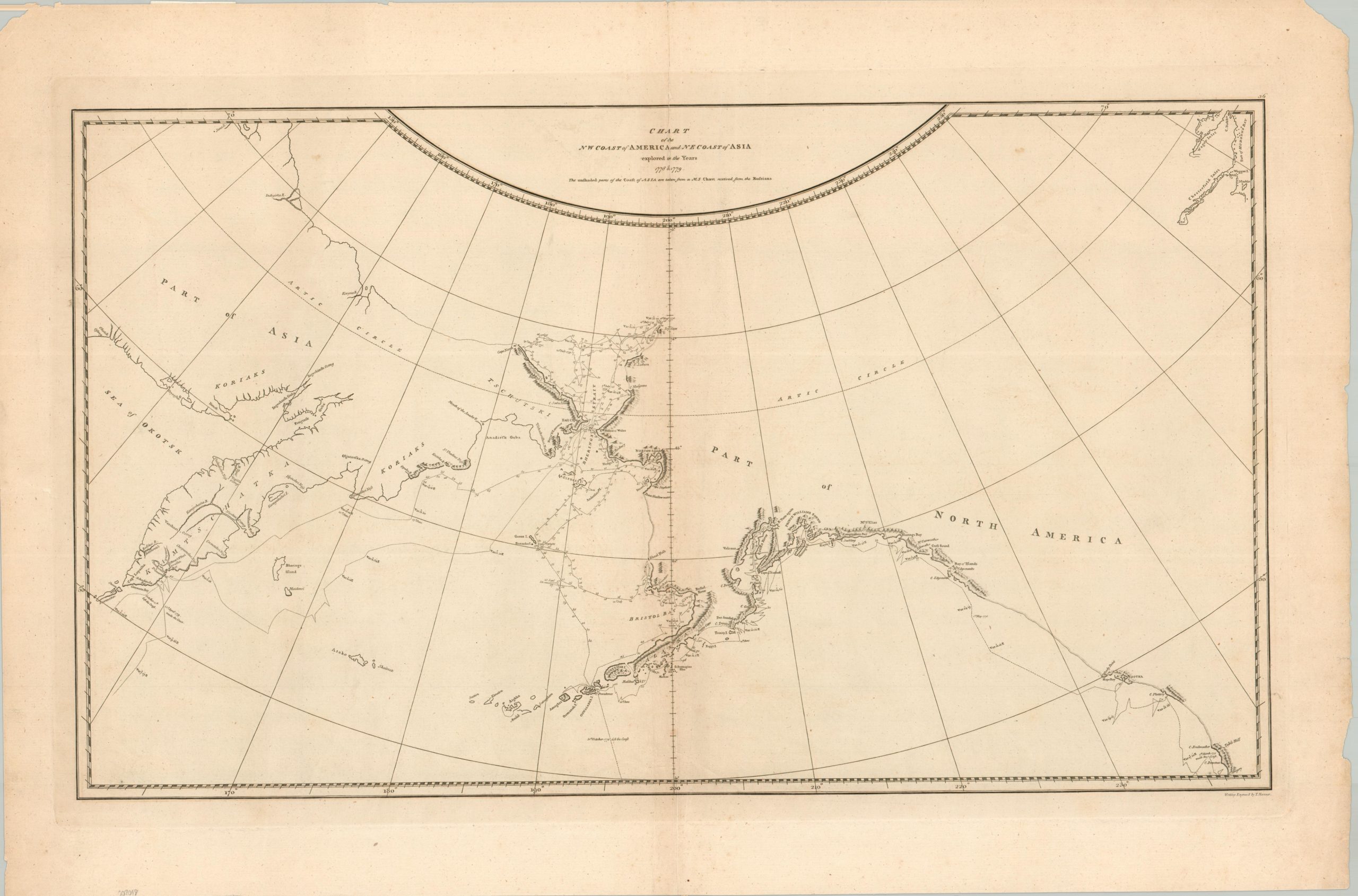
Chart of the NW Coast of America and NE Coast of Asia Explored in the Years 1778 & 1779
$26.43
$48.63
During his third voyage (1776-1779), Captain James Cook extensively explored the northwest coast of North America, meticulously charting the Alaskan coastline and the Bering Strait in search of the elusive Northwest Passage. After being stopped by ice in the Arctic, the HMS Resolution and HMS Discovery sailed south to warmer waters. It was the shores of Kealakekua Bay, Hawaii, that Cook met his death at the hands of natives in February 1779. The crew continued to search along the coast of Siberia and the Kamchatka Peninsula before returning home. This detailed map of the coastline is a result of the exhaustive efforts made by Cook and his crew in the frigid waters of the North Pacific. It represents some of the most accurate cartography of the region for the time, noting coastal topography, major geographic features, and speculative shorelines. The track of the ships can be followed along with respective dates of travel – the line changes from hashes to dots to signify pre- and post-Cook routes. The map was drawn by Lieutenant Henry Roberts using direct input from Captain Cook. This example was engraved by T. Harmar and published in the 1784 edition of Cook’s Voyage to the Pacific Ocean (the first edition). The publication of the map was a point of political contention due to its inherent strategic value. Sources: David Rumsey Map Collection; National Library of Australia; Stanford University;