SACTRATTURARTE.IT ≡ Pj-Tennarit Inlei Memory Cards 18Th Century
  • Australia & Oceania

  • Hawaiian Group or Sandwich Islands

Hawaiian Group or Sandwich Islands

$15.02 $19.08
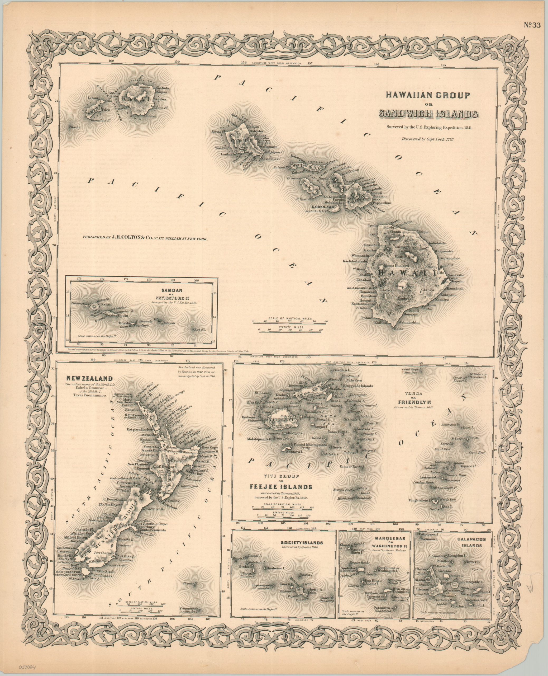
Seven maps in one, this page from a Colton atlas shows the Hawaiian Islands as they were surveyed by the U.S. Exploring Expedition in 1841. Six other maps of island groups are shown, charted by European and American explorers in the 17th, 18th, and 19th centuries. Each image presents topographical relief, towns, and reefs of areas that were economically important for their natural resources and as stopovers for ships. New Zealand, Fiji, the Galapagos, the Society Islands, Tonga, and the Marquesas Islands are all included.
Australia & Oceania

Australia & Oceania

  • Queensland Excluding South-West and Peninsula Areas
    $30.67 $51.53
  • Hawaiian Group or Sandwich Islands
    $15.02 $19.08
  • Chart of the NW Coast of America and NE Coast of Asia Explored in the Years 1778 & 1779
    $26.43 $48.63
  • Victoria, New South Wales, and South Australia
    $34.37 $67.37
  • The Thermal Wonderland of Rotorua
    $21.62 $39.56
  • The Pacific Ocean
    $18.4 $35.14

© 2026 - SACTRATTURARTE.IT