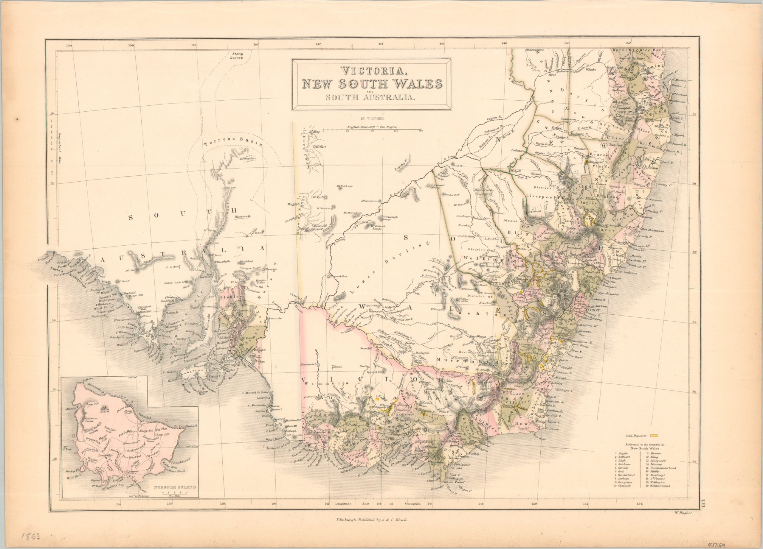
This detailed image covers a large region across southern Australia, including the states of South Australia, New South Wales, and Victoria. The last was established as a separate colony in 1851 as a result of a massive population boom from the Victorian Gold Rush. Numerous gold deposits are highlighted in yellow and a fascinating variety of settlements, geographic features, and districts are labeled. An inset in the lower left shows Norfolk Island, in use as a penal colony for a few more years before it was settled by the descendants of the Bounty Mutineers in 1856. The map was published in Edinburgh in 1853 by A. & C. Black.