Queensland Excluding South-West and Peninsula Areas
$30.67
$51.53
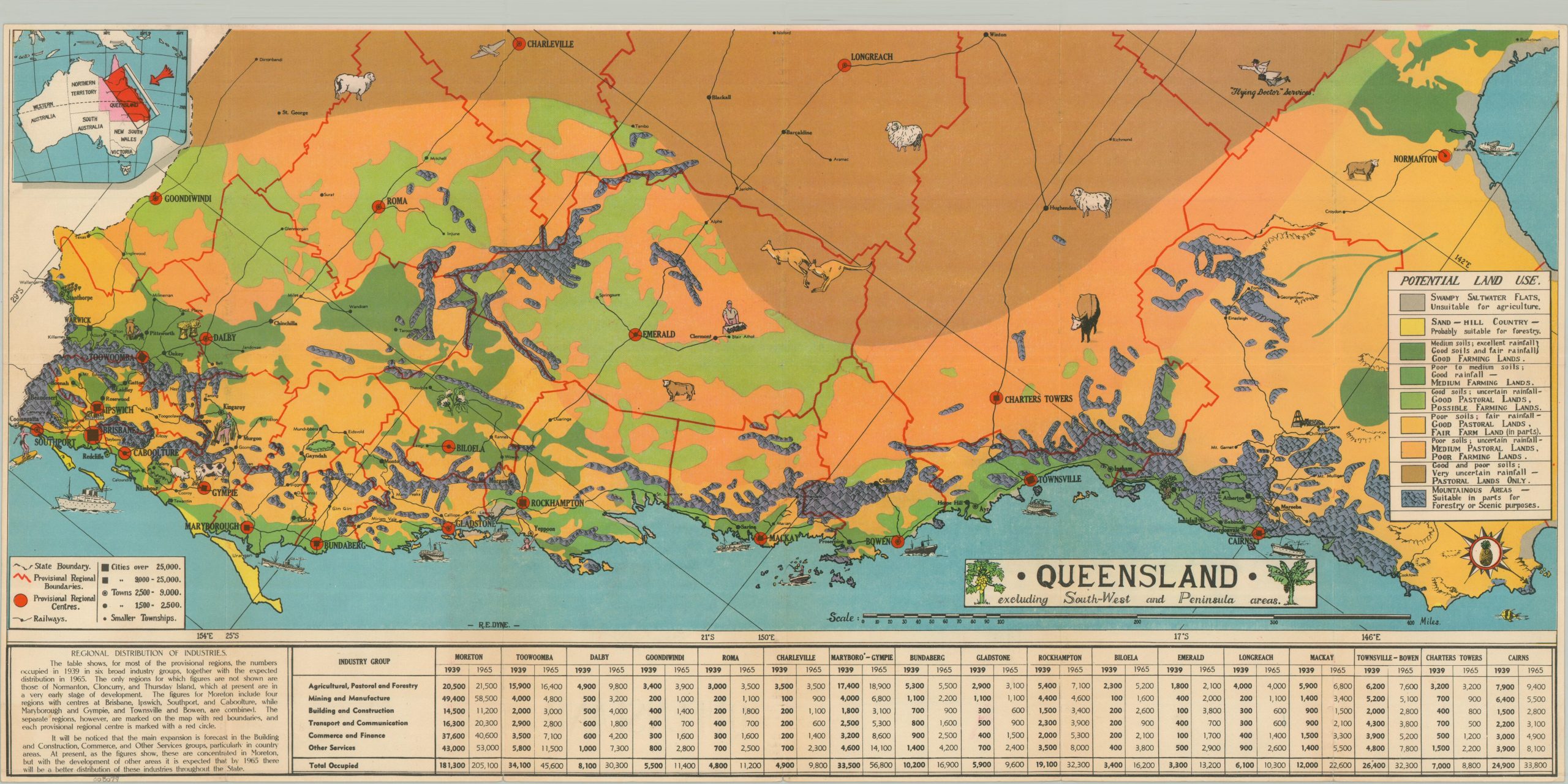
This brightly colored map covers the coastal majority of the Australian territory of Queensland. Different shades of green and brown highlight variations in the landscape, which includes rugged mountains, salty swampwater flats, rich farmland, and barren pastoral plains. Major cities are noted, along with the regional railway network and major industries. A text box in the lower left generalizes the findings and is accompanied by a table that forecasts the growth of six different industry groups through 1960. The map was designed by R.E. Dyne (signed, lower center) and prepared by the Australian Bureau of Industry. Printed in Brisbane in 1945 by A.H. Tucker. With the end of WWII on the horizon, post war reconstruction and economic revitalization were a top priority for many Allied governments.