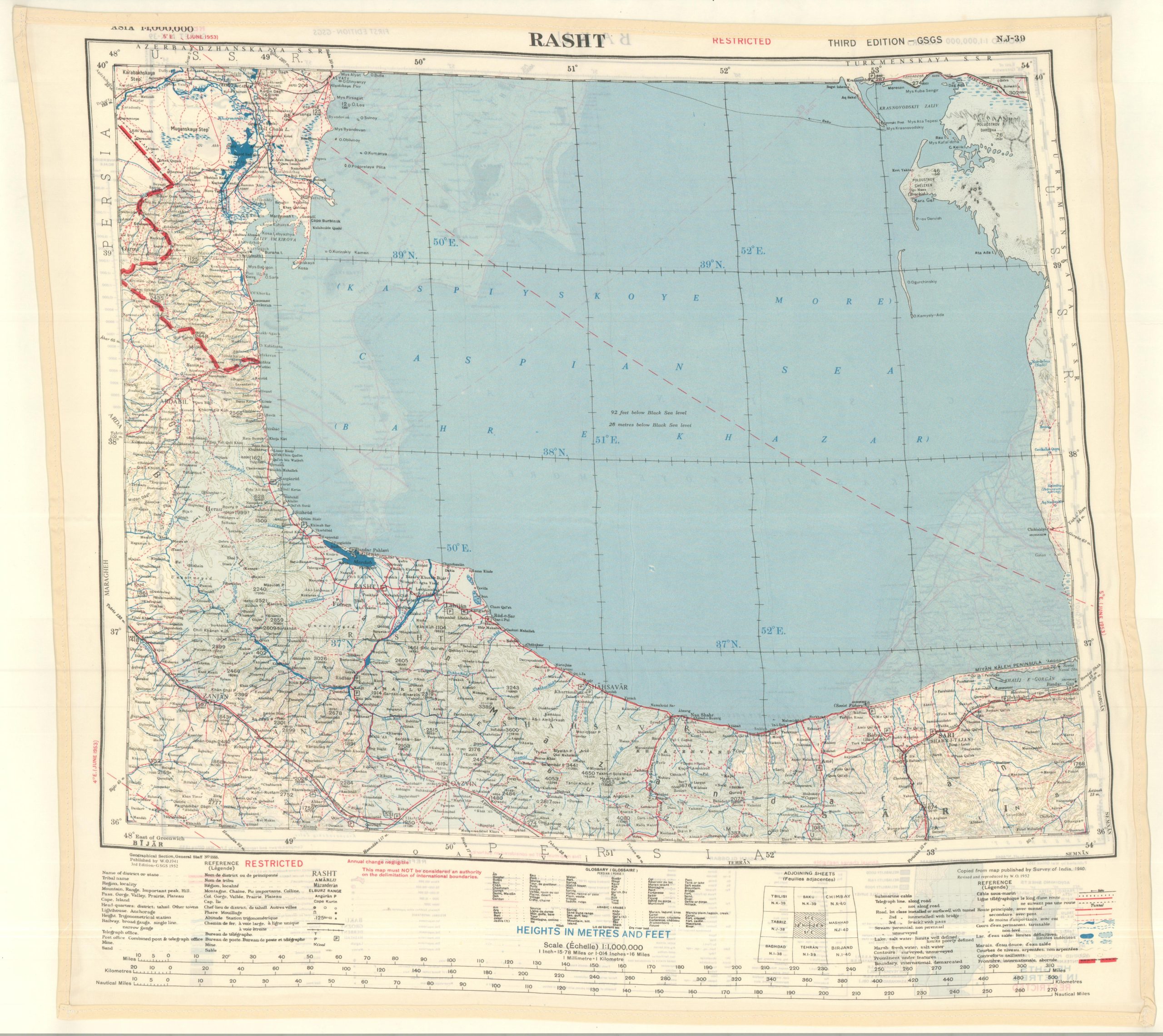
This fascinating relic from the Cold War provides a high-level overview (issued at a scale of 1:1,000,000) of the southern half of the Caspian Sea and its adjacent coastlines. One side is centered around the Soviet city of Baku (in modern-day Azerbaijan), while the verso focuses on the area around the Iranian city of Rasht. The map, printed on synthetic cloth, was issued for use by aviators who might be operating in the potentially hostile region. The design is useful in tricky situations – quiet to use, easy to conceal, waterproof, and sturdy. The content leaves something to be desired, offering only a rudimentary overview of the local transportation network and basic geographic details. The ‘escape map’ was published by the Geographical Section, General Staff in 1952. At the time, the British military had a significant interest in preserving Iran as a buffer state against Soviet encroachments, especially as the nationalization of oil industries further intensified regional animosities. In 1953, the U.S. and U.K. orchestrated a coup d’etat and helped to overthrow the Prime Minister of Iran, Mohammad Mosaddegh, in large part to protect those commercial energy interests.