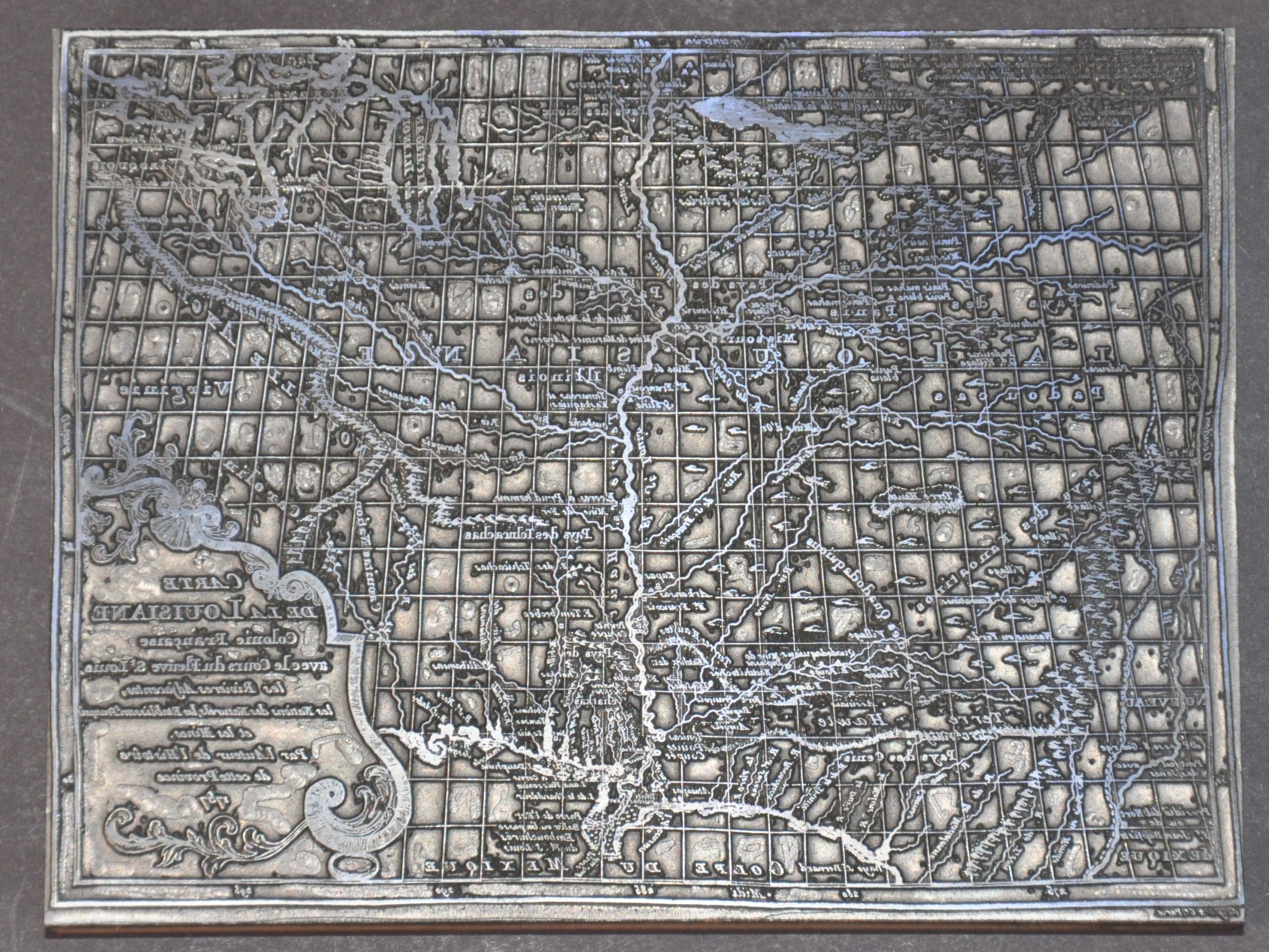
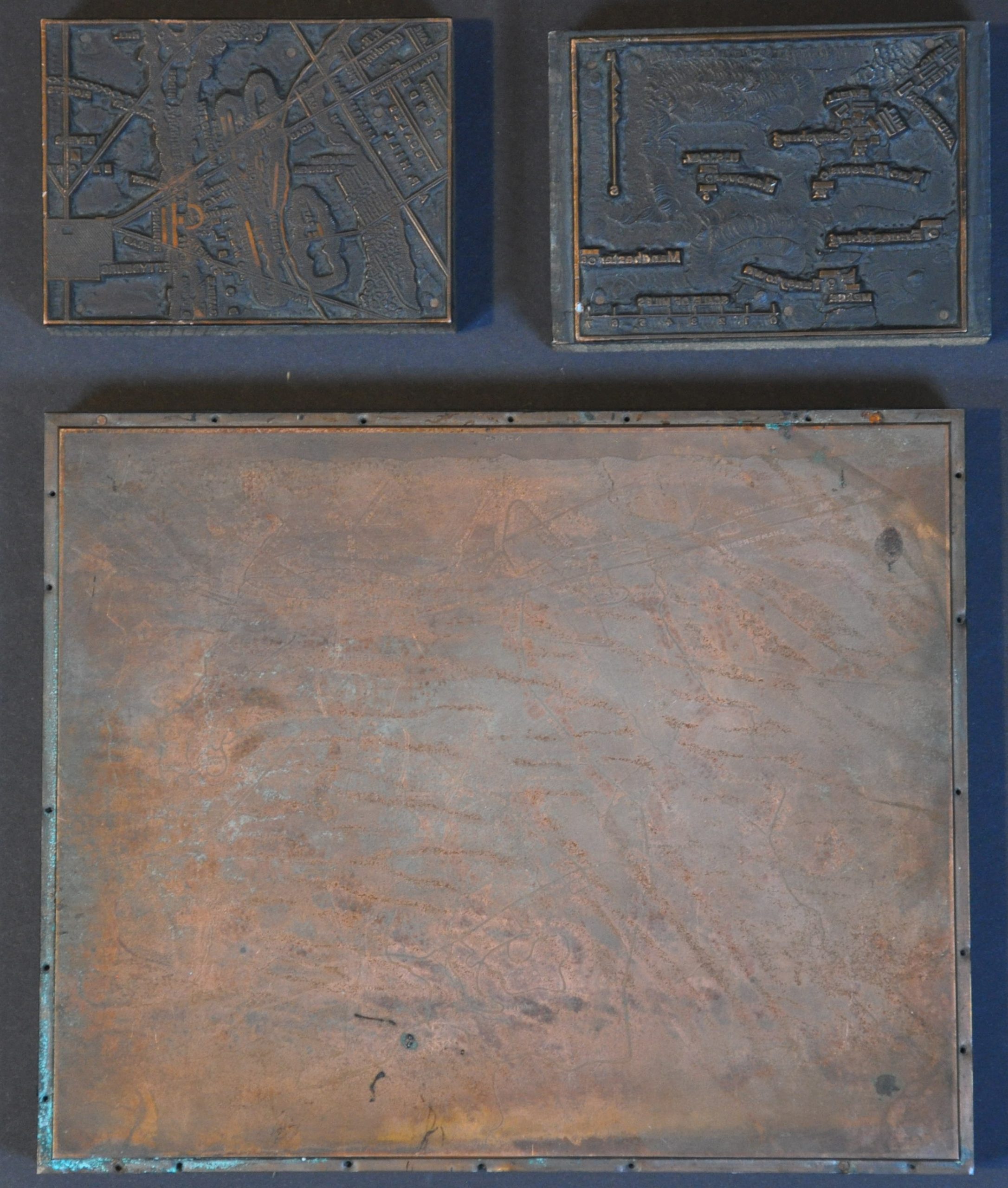
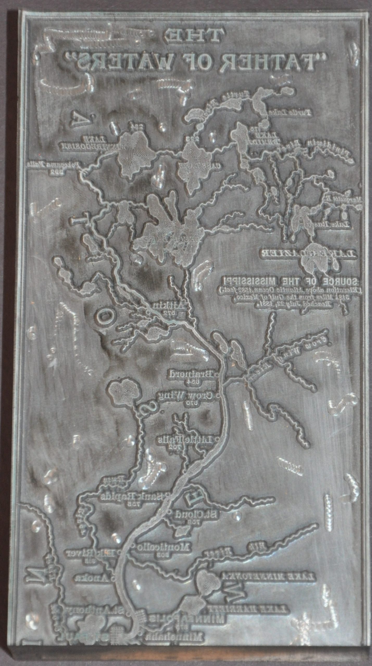
This fascinating metal print block replicates the top portion of a 3’ long map of the Mississippi River, originally issued by Captain Willard Glazier to illustrate his supposed discovery of the headwaters of the ‘Father of Waters.’ Despite strong evidence showing otherwise, Glazier relentlessly promoted his claims with several widely produced maps – this appears to replicate the version originally used in an early edition (c. 1887) of Down the Great River. Embracing An Account Of The Discovery Of The Source Of The Mississippi. The block was used to print the map in the September 1970 issue of the Palimpsest, a monthly publication of the State Historical Society of Iowa. The original caption read, in part, “This section of the map locates what Glazier mistakenly claimed as the source of the Mississippi in Lake Glazier. It follows the canoeists from Lake Itasca to the Minneapolis-St. Paul area.” Source: Cornell University; Palimpsest (digitized copy courtesy of Iowa Historical Society)