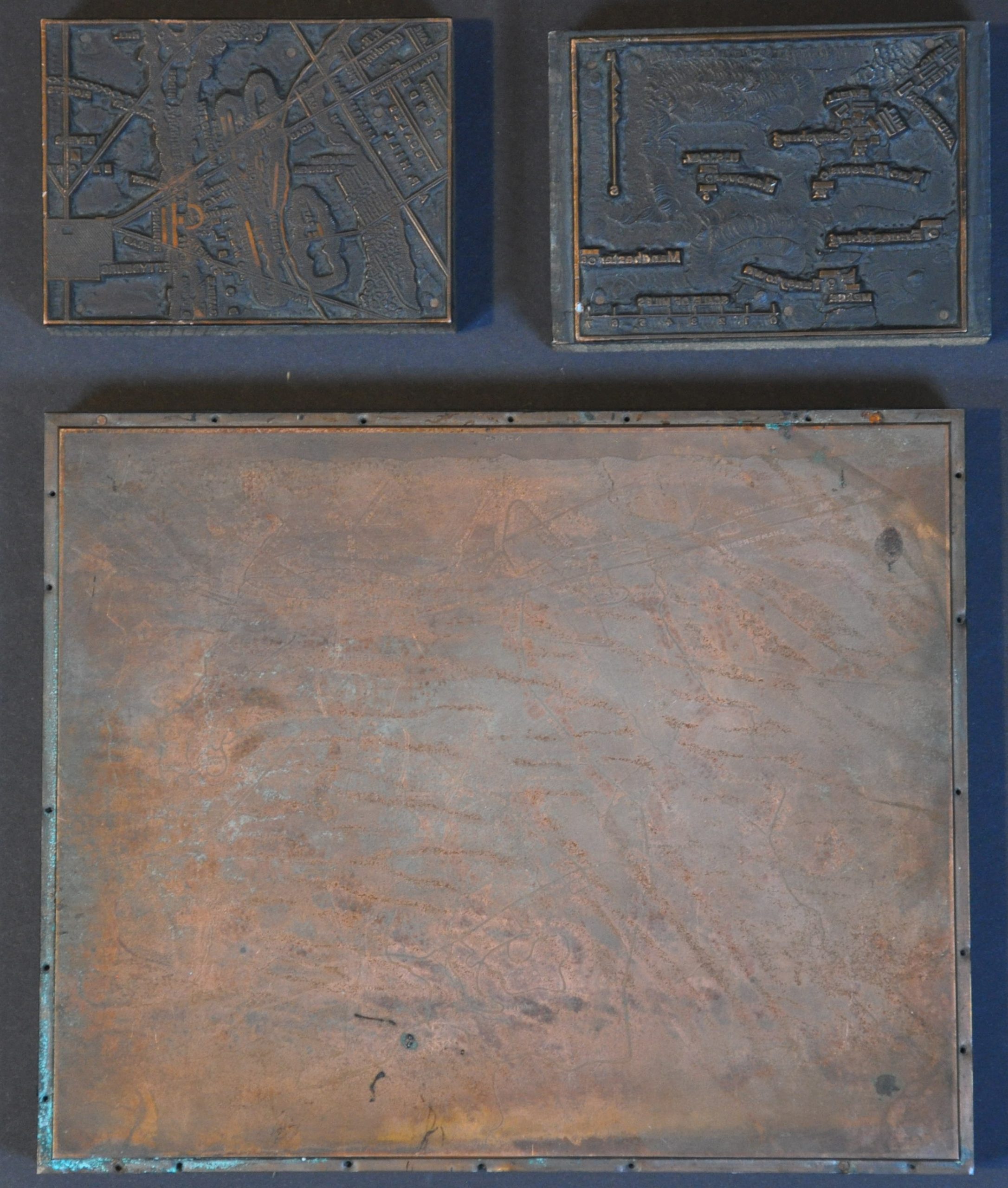
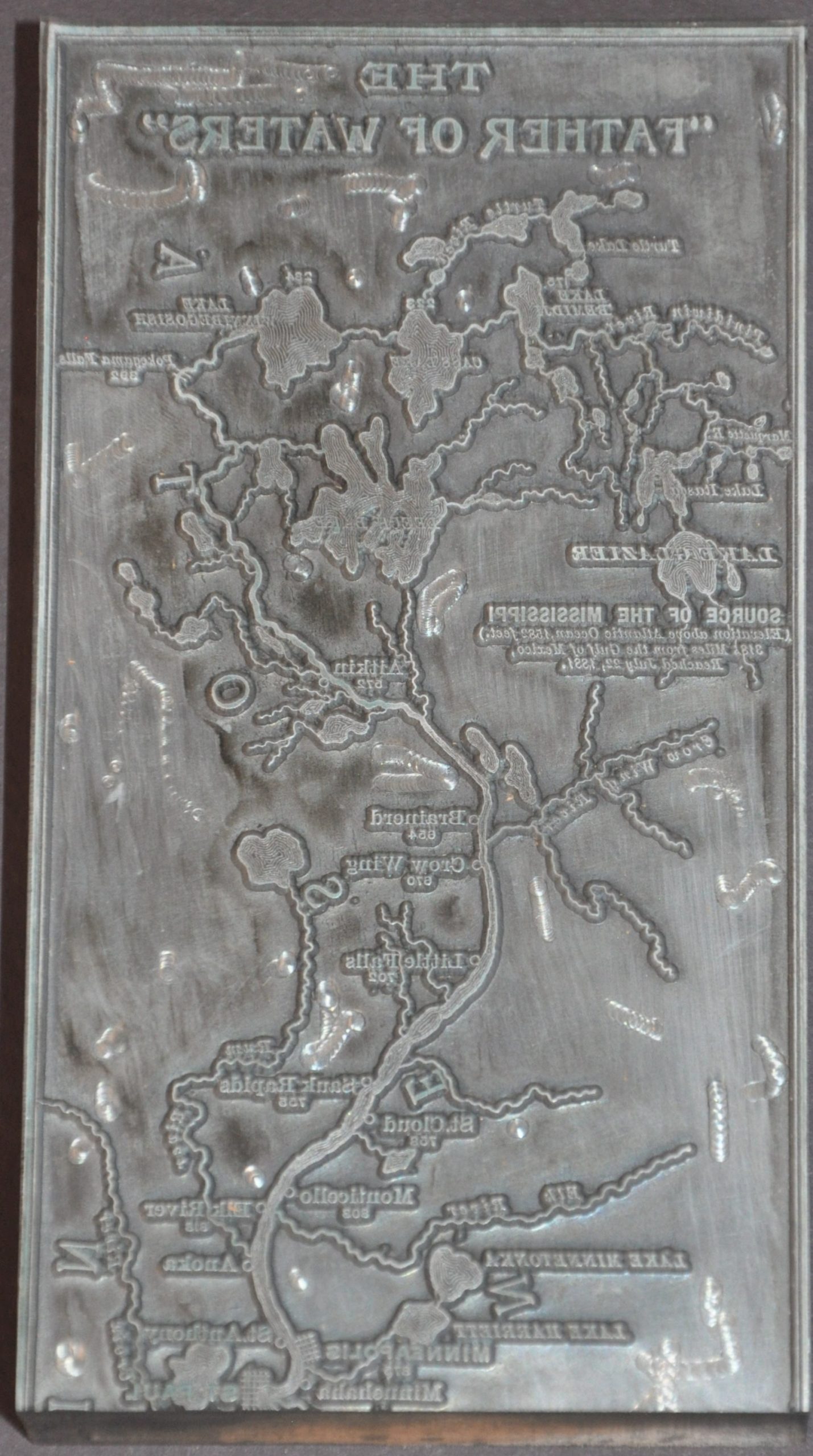
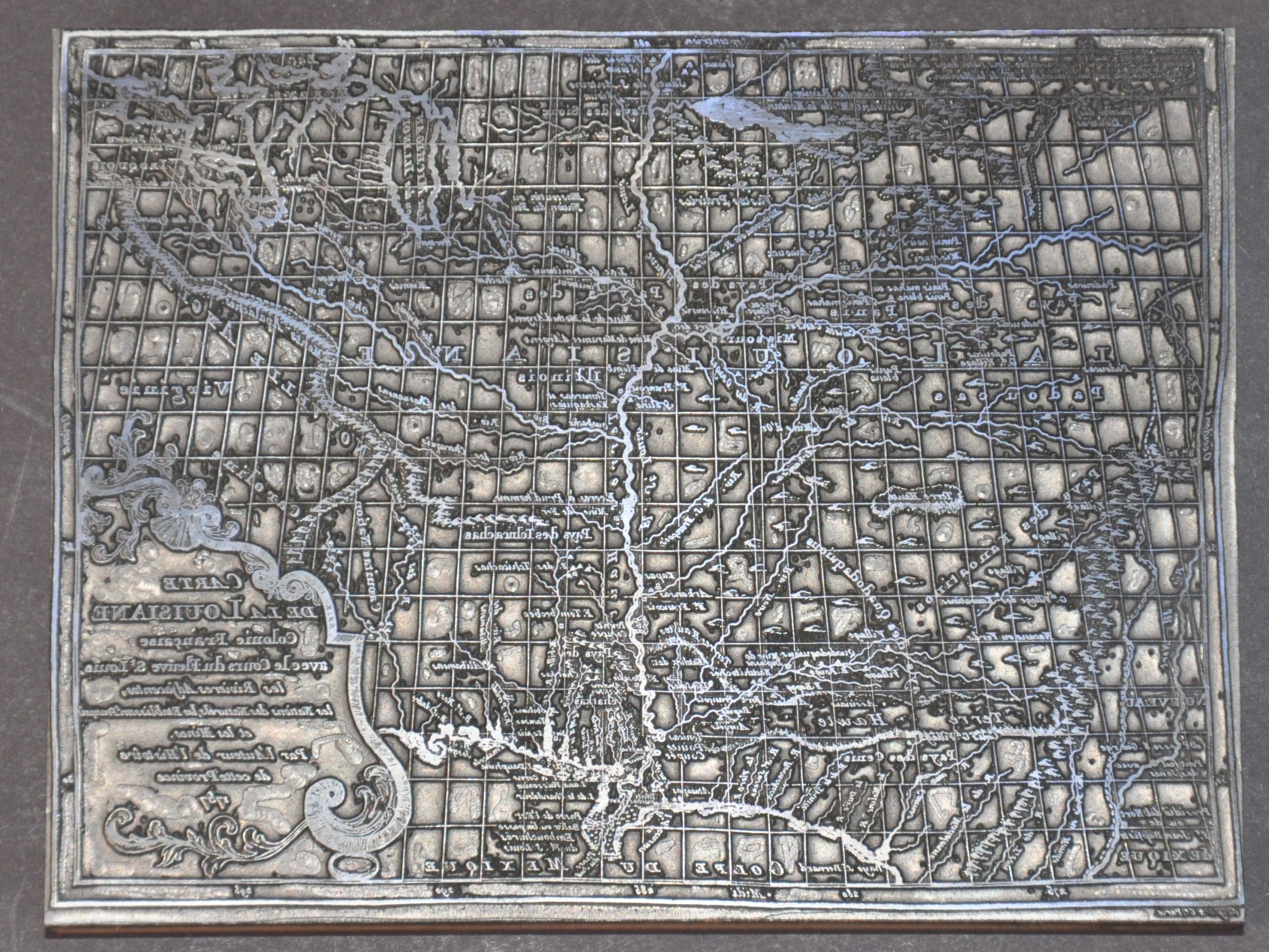
Carte De La Louisiane Colonie Française avec le Cours du Fleuve St Louis [Print Block]
$14.96
$24.09
This fascinating print block was used to replicate a scarce French map, Carte de la Louisiane Colonie Française avec le Cours du Fleuve St. Louis, les Rivieres Adjacentes, les Nations des Naturels, les Stablissems. Francaise et les Mines, first created in the 1750s by Antoine Simon le Page du Pratz, a longtime resident of the Louisiana Territory. The image highlights the expansive French claims on both sides of the Mississippi River, noting Native American villages, European forts, and contemporary cartographic misconceptions (like Lahontan’s Grande Riviere). The block was used to print the map in the March 1966 issue of the Palimpsest, a monthly publication of the State Historical Society of Iowa. The original caption read (apparently erroneously, since the map was first published in le Page du Pratz’s Histoire de la Louisiane 1758), “Five years after this map appeared (1762), France ceded all land west of the Mississippi to Spain.” Sources: Louisiana Anthology; Library of Congress; Lewis & Clark.org; University of Iowa (Full Palimpsest magazine digitized)