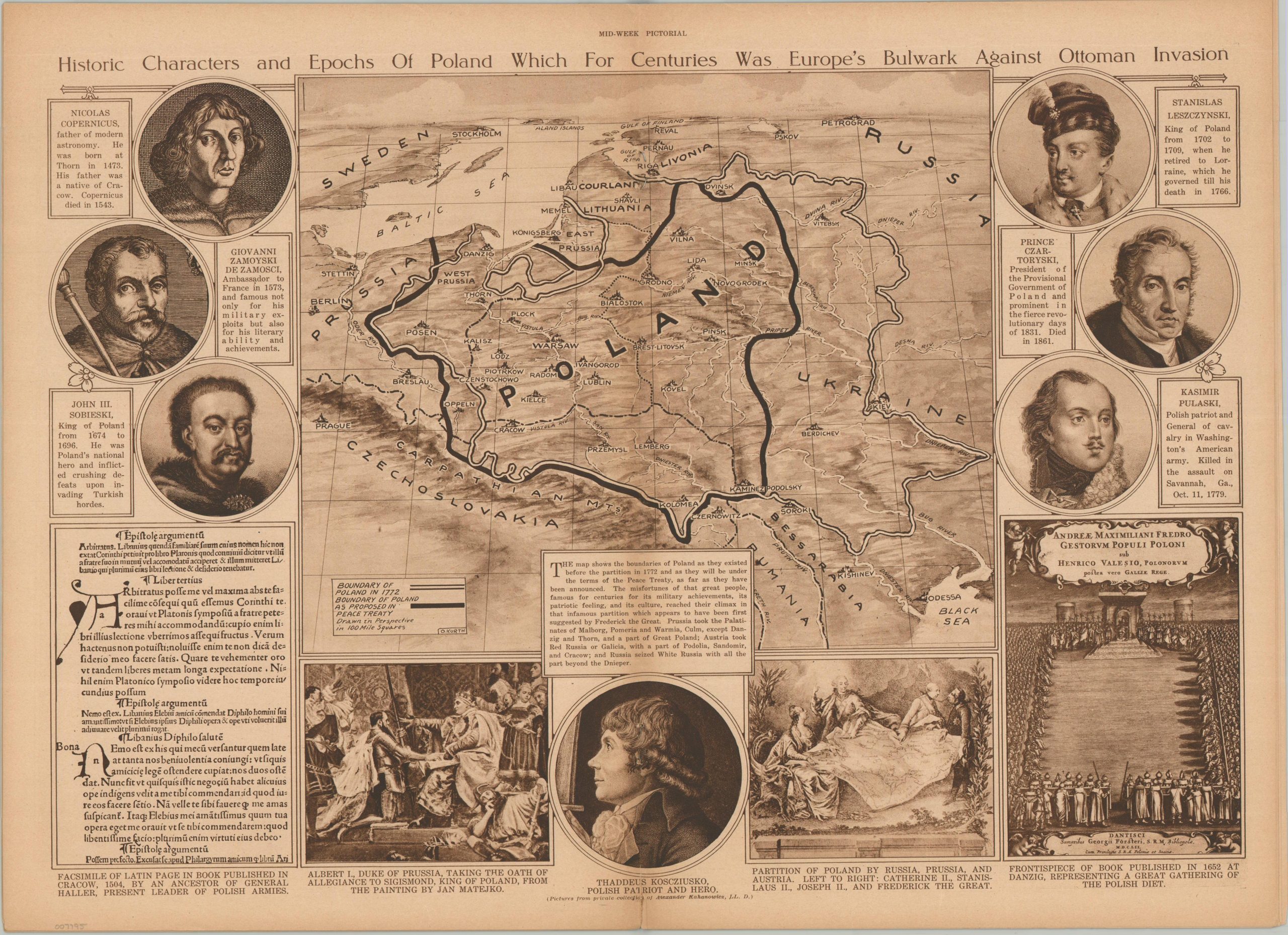
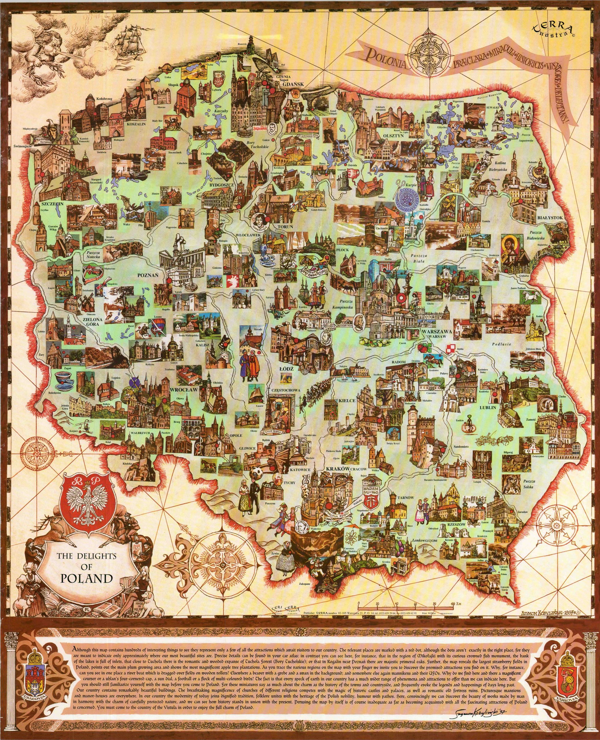
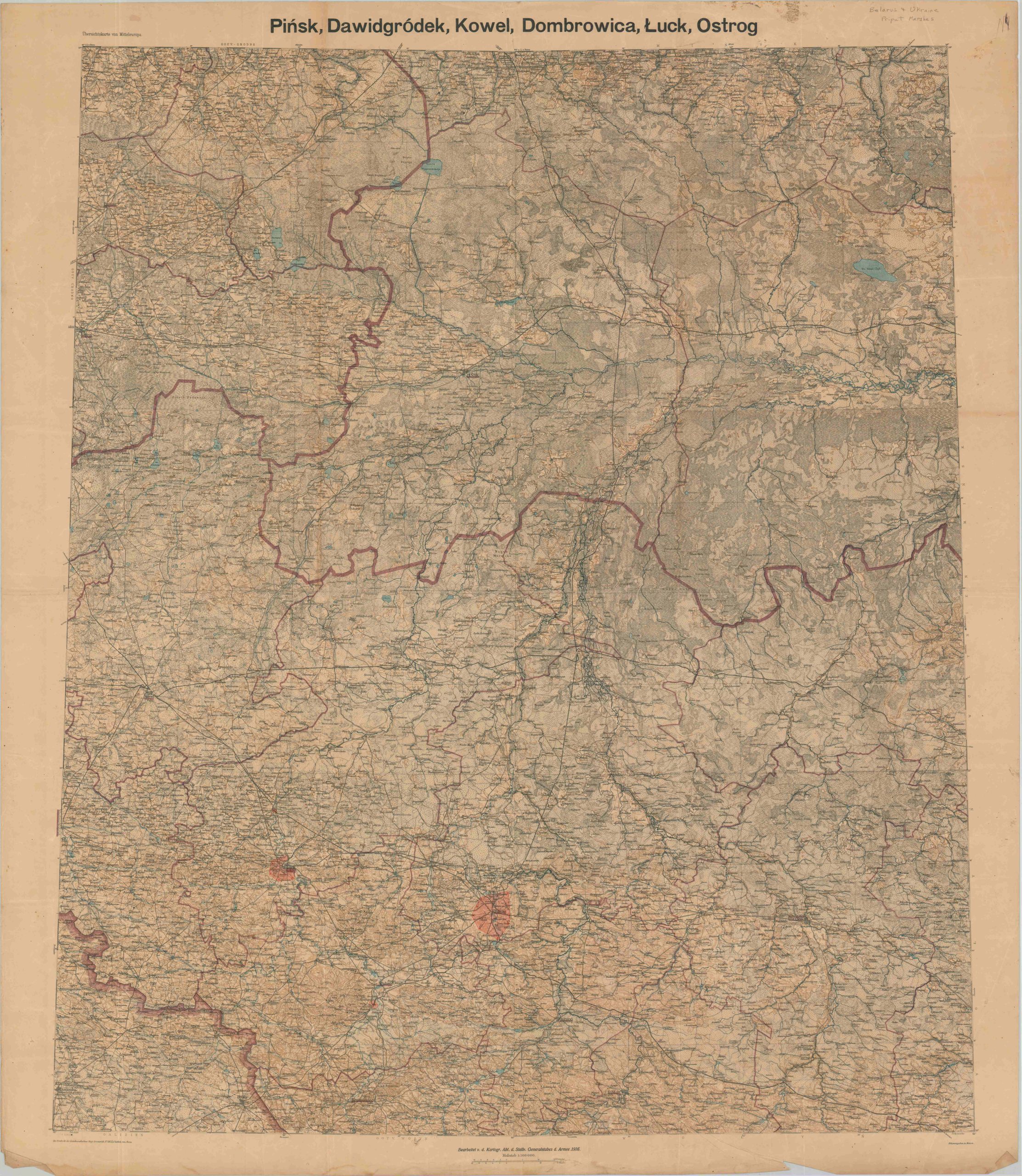
This detailed map covers the primary manmade infrastructure and geographic features across a large area in Eastern Europe, including portions of Poland, Ukraine, Moldova, Hungary, Romania, Czechoslovakia, and the Soviet Union. The somewhat confusing image (different areas are presented on either side) is helpfully keyed with the national territories named along the border. A multi-language glossary of terms is also provided to assist with deciphering the various features. The local transportation system is emphasized, contours are given at 100-meter intervals, and marshes/swamps are shown pictorially – all extremely useful characteristics if the reader finds themselves on foot in the area. The map was originally published by the Geographical Section, General Staff of the British War Office in 1944. This is the third edition, marked RESTRICTED and updated (with input from the Ordnance Survey) to June of 1953. The sheet, printed on sturdy synthetic cloth material, was originally issued for British military personnel. Easy to conceal, packed with information, waterproof, and quiet to use – the design was ideal for planning and operations in hostile territory.