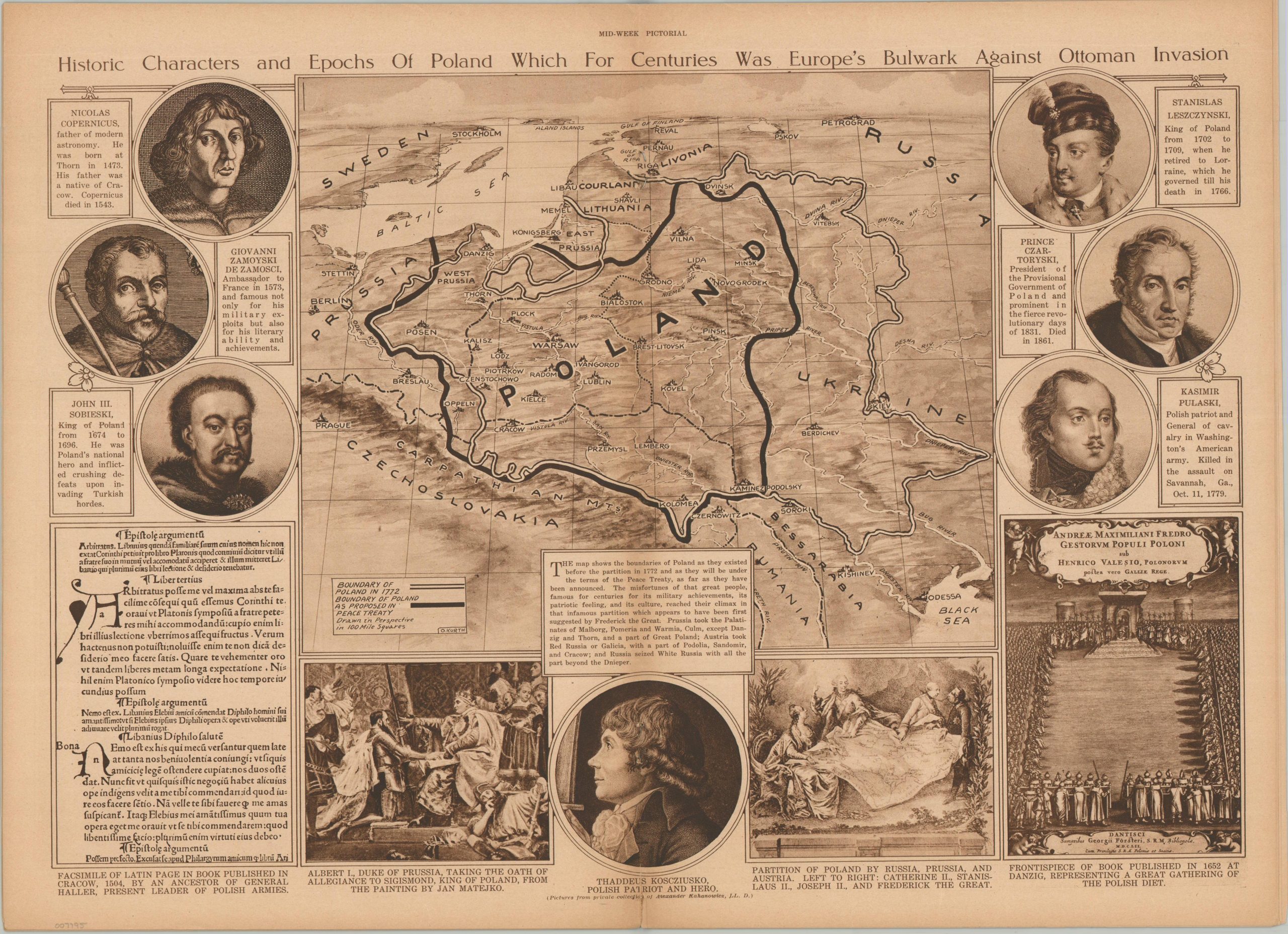
Historic Characters and Epochs of Poland Which for Centuries Was Europe’s Bulwark Against Ottoman Invasion
$27.86
$48.2
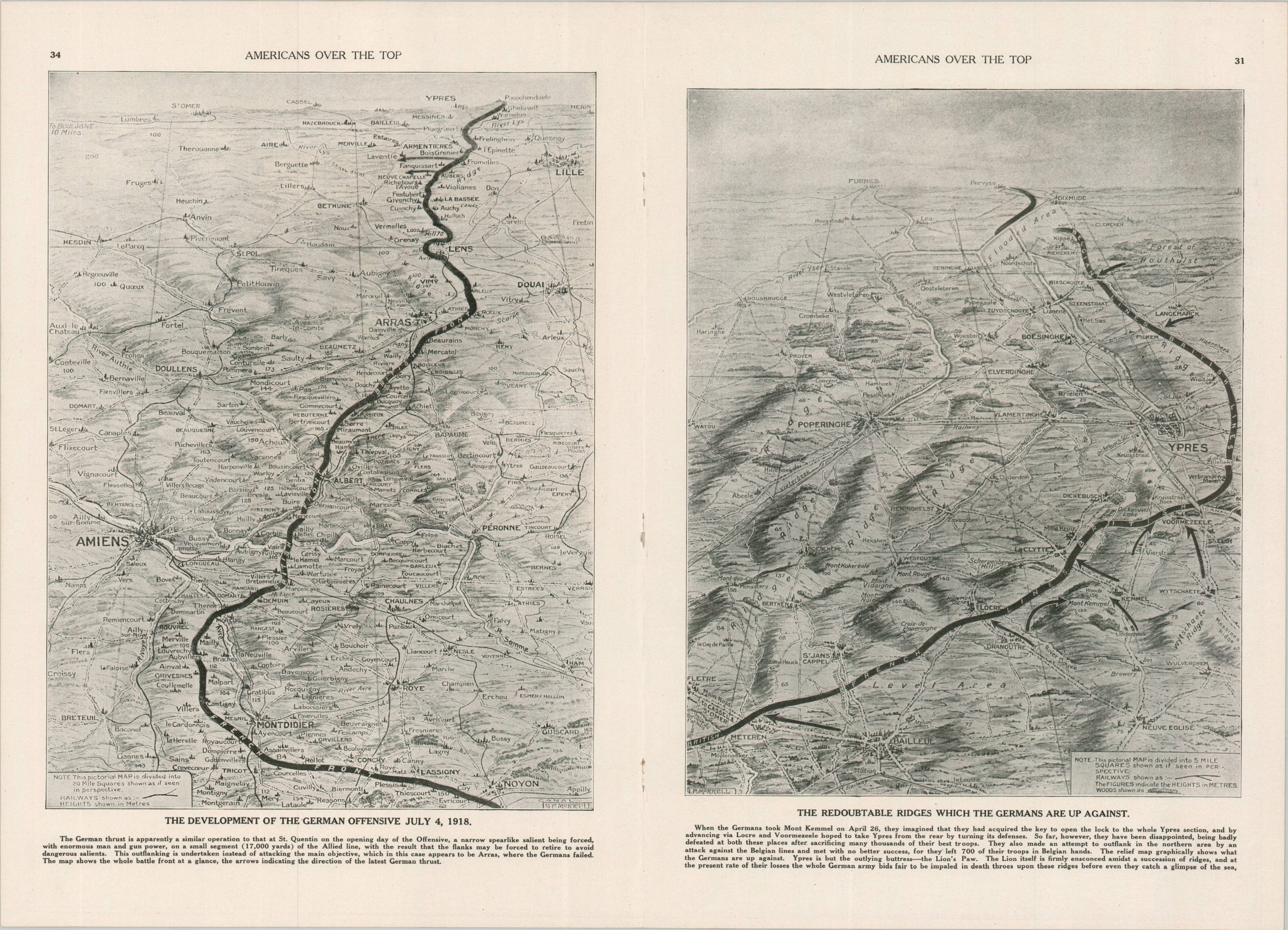
“The map shows the boundaries of Poland as they existed before the partition in 1772 and as they will be under the terms of the Peace Treaty, as far as they have been announced. The misfortunes of that great people, famous for centuries for its military achievements, its patriotic feeling, and its culture, reached their climax in that infamous partition which appears to have been first suggested by Frederick the Great.” – Text, lower center. This punchy persuasive map of Poland was illustrated by Otto Kurth and published as the centerfold in the June 19, 1919 edition of the New York Times’ Mid-Week Pictorial. The central image presents the historic 1772 boundaries of Poland (white) and the borders of the newly revived independent Polish state (black), as proposed for the Treaty of Versailles. The latter, clearly truncated from their imperial height a century and a half earlier, include the ultimately free city of Danzig, plus some territory that was formerly German. Captioned images in the borders outline the rich (Christian) heritage of Poland, including important historic figures and events.