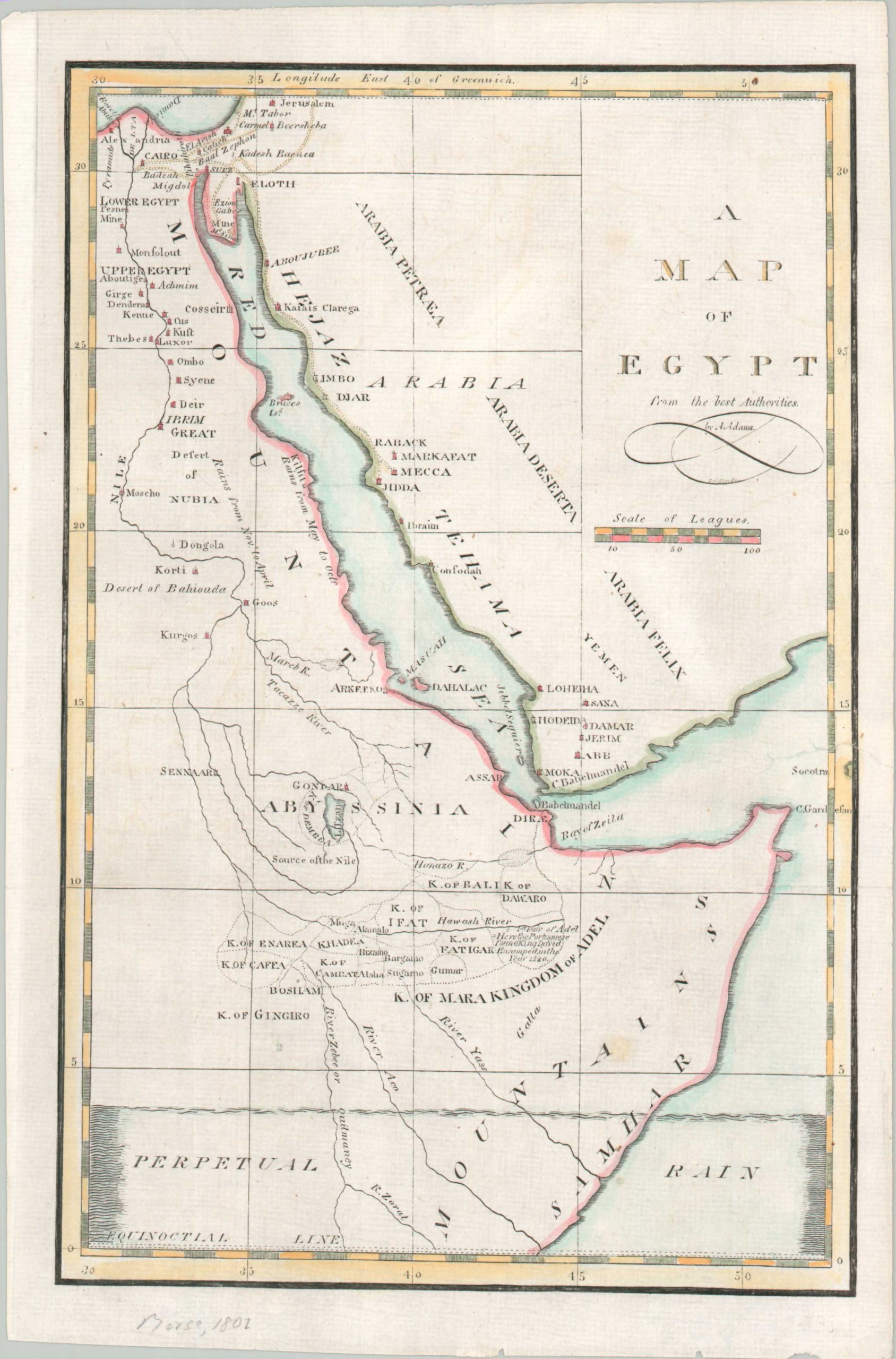
This somewhat unusual map of Egypt was drawn by A. Adams and published in a geography textbook by Jedidiah Morse around 1802. The image focuses on the eastern part of the ancient nation, following the course of the Nile from the Mediterranean to its source near the historic city of Gondar – correctly identified as Lake Tana (for the Blue Nile branch). Numerous African kingdoms are outlined north of a large area marked ‘Perpetual Rain.’ Nearby, Ethiopia’s long Christian history is referenced with a note that reads “Here the Portuguese found King David Encamped in the Year 1520.” Several major cities are labeled opposite the Red Sea, including Moka, Mecca, and Jeddah.