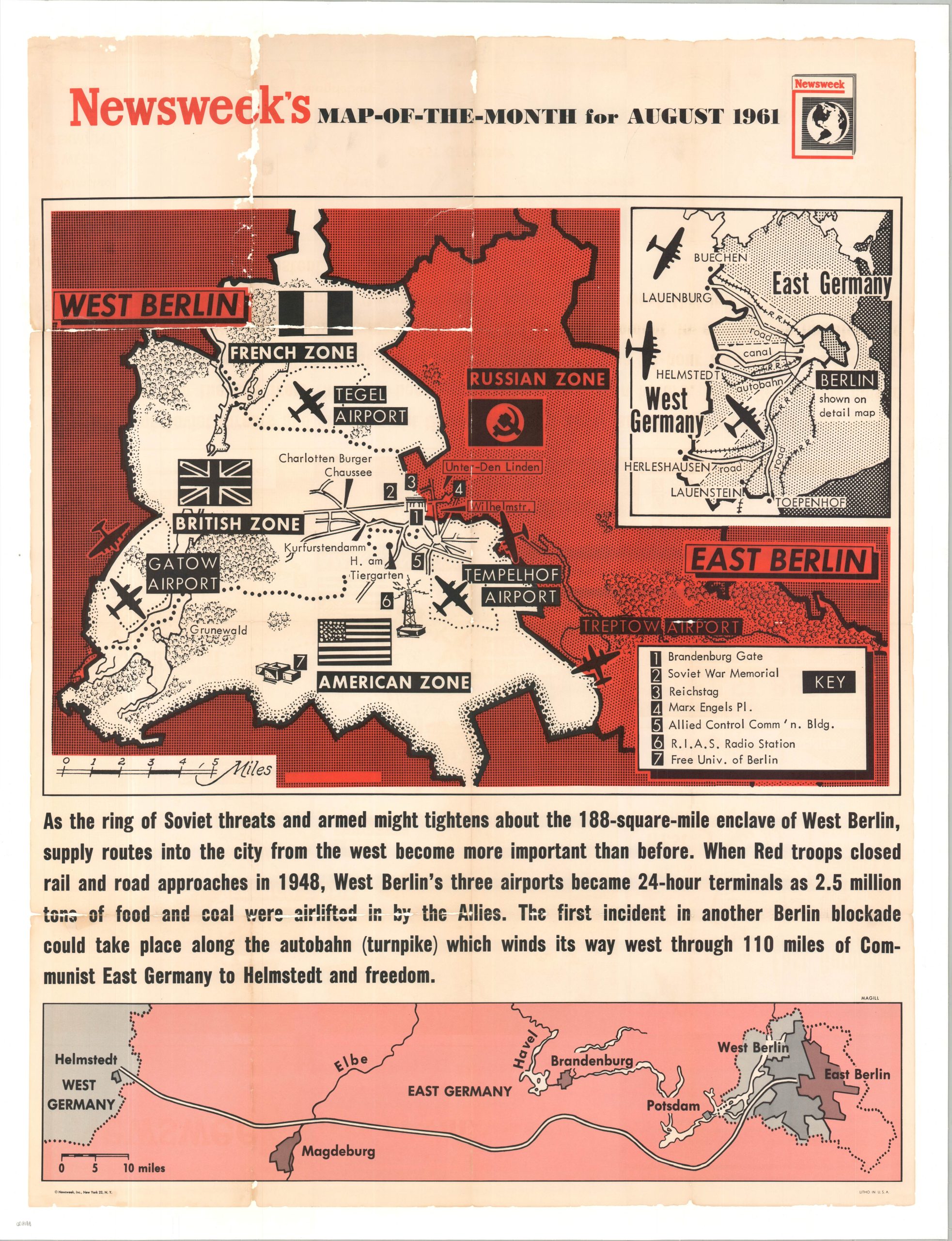
Newsweek’s Map-of-the-Month for August 1961 [Berlin Wall]
$18.76
$23.45
This eye-catching wall map was published by Newsweek, Inc. in 1961 for its August ‘Map of the Month’. The two-tone image depicts the rising wall (literally and figuratively) between East and West Berlin. A rudimentary outline of the starkly divided city notes a handful of major features, including airports, occupation zones, and major landmarks. Insets in the upper left and along the bottom highlight the primary mechanisms for possible resupply to the surrounded enclave of West Berlin – via airlift and the Autobahn (though this latter option never occurred, due to Soviet interference). The primary purpose of the Berlin Wall was to halt the “brain drain” of East German citizens who were fleeing to the West at a rate of nearly 2,000 people per day by 1961. Under the cover of darkness in the middle of August, East German soldiers and workers sealed the border with miles of barbed wire and torn-up pavement. This sudden barricade trapped families on opposite sides of the street and led to desperate, last-minute escape attempts. By the end of the month, the temporary wire was replaced by permanent hollow-block masonry, solidifying the symbolic “Iron Curtain” that would divide the world for the next three decades.