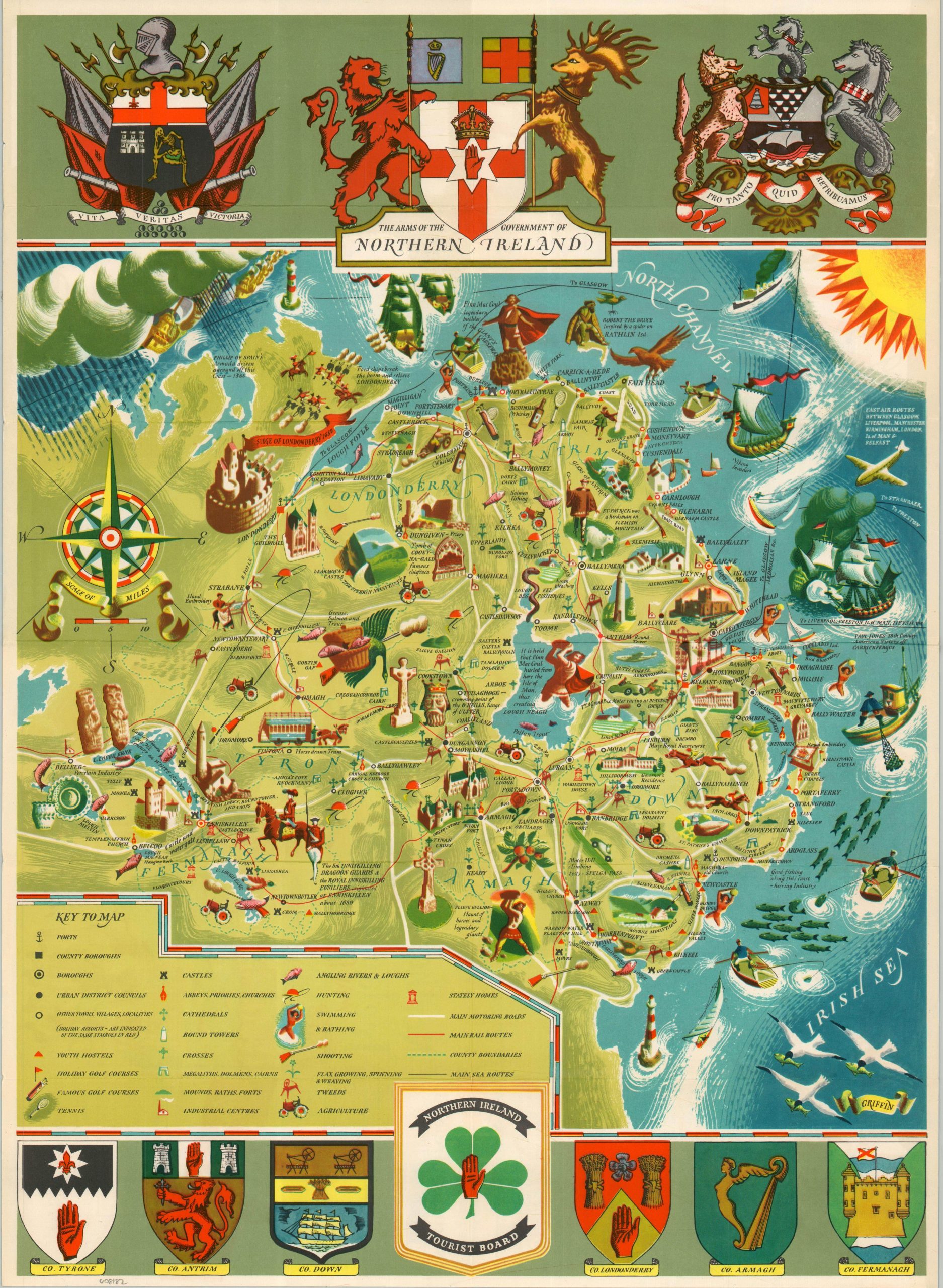
This beautiful pictorial map of Northern Ireland was issued about thirty years after the region was politically ‘split’ from the rest of the island. An inviting array of tourist attractions, historic sites, important industries, recreational opportunities, and transportation options is noted throughout the colorful image. Celtic crosses, cairns, round towers, and vibrant shades of green reflect universal Irish themes, though the stately homes, scantily clad women, and hunting clubs highlight strong British influence. St. Patrick and Finn MacCoul are depicted alongside the Siege of Londonderry and the Royal Inniskilling Fusiliers. The upper and lower portions of the sheet include prominent coats of arms, several of which include the Red Hand of Ulster. The map, sponsored by the Northern Ireland Tourist Board, is signed ‘Griffin’ in the lower right – most likely Frederick Griffin. Published by the Tourist Information Centre in Belfast in 1950. Lovely artwork on the verso is credited to Douglas Rowel Friers.