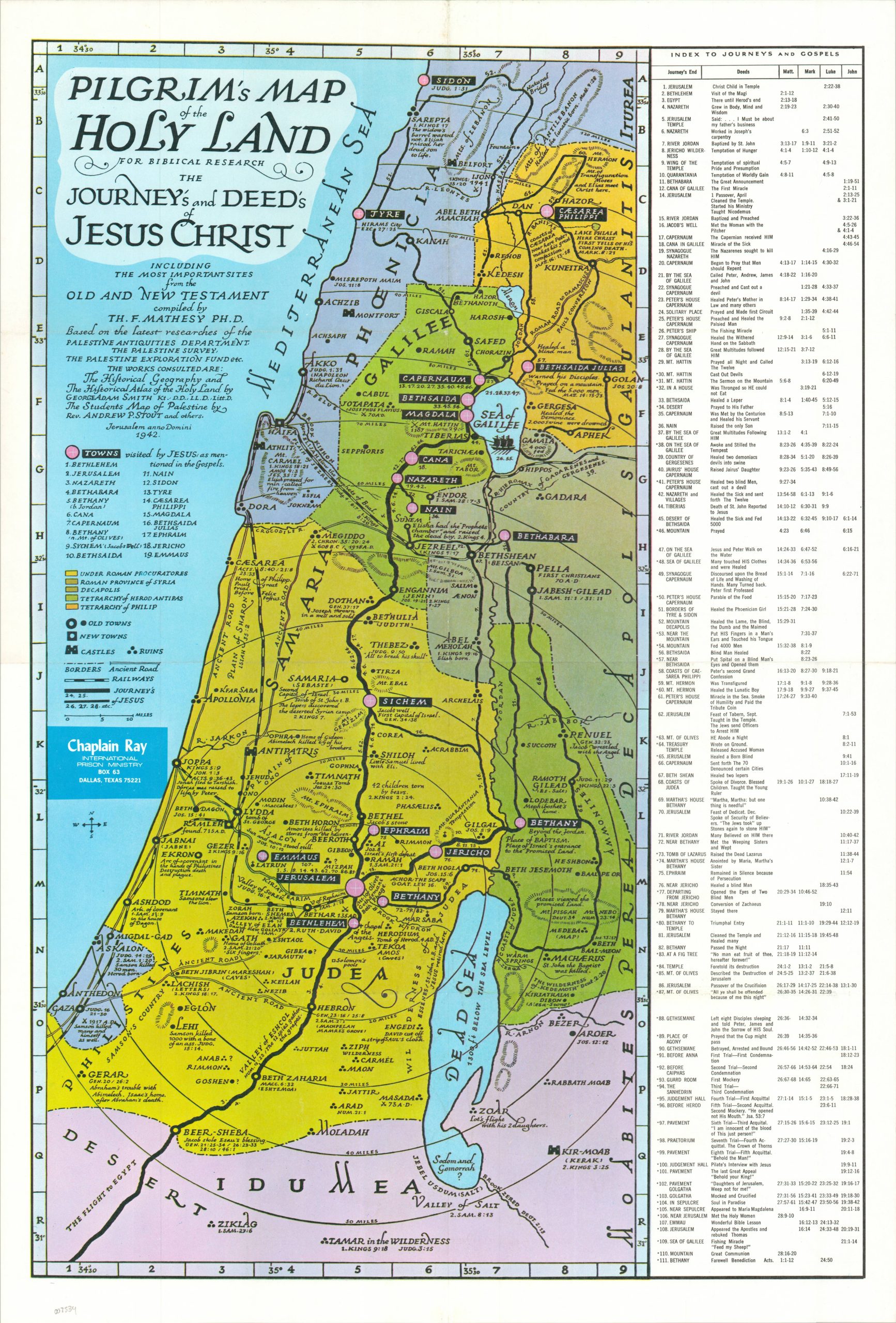
This informative historical map of Jesus’s travels throughout the Holy Land was originally compiled and published in 1942 by Dr. Theodore Mathesy in Jerusalem. This is a later edition, issued in the second half of the 20th century by Ray Hoekstra as part of his International Prison Ministry. Bright colors identify territorial ownership according to the accompanying legend while text and symbols describe the various places visited and routes undertaken. The 19 towns visited by Jesus, according to the Gospels, are numbered and identified within the image. An index on the right side lists 110 different stops on Christ’s journey, with his respective deeds and the supporting Bible verses listed for reach. A visual cartographic companion to the Gospels of Matthew, Mark, Luke, and John.