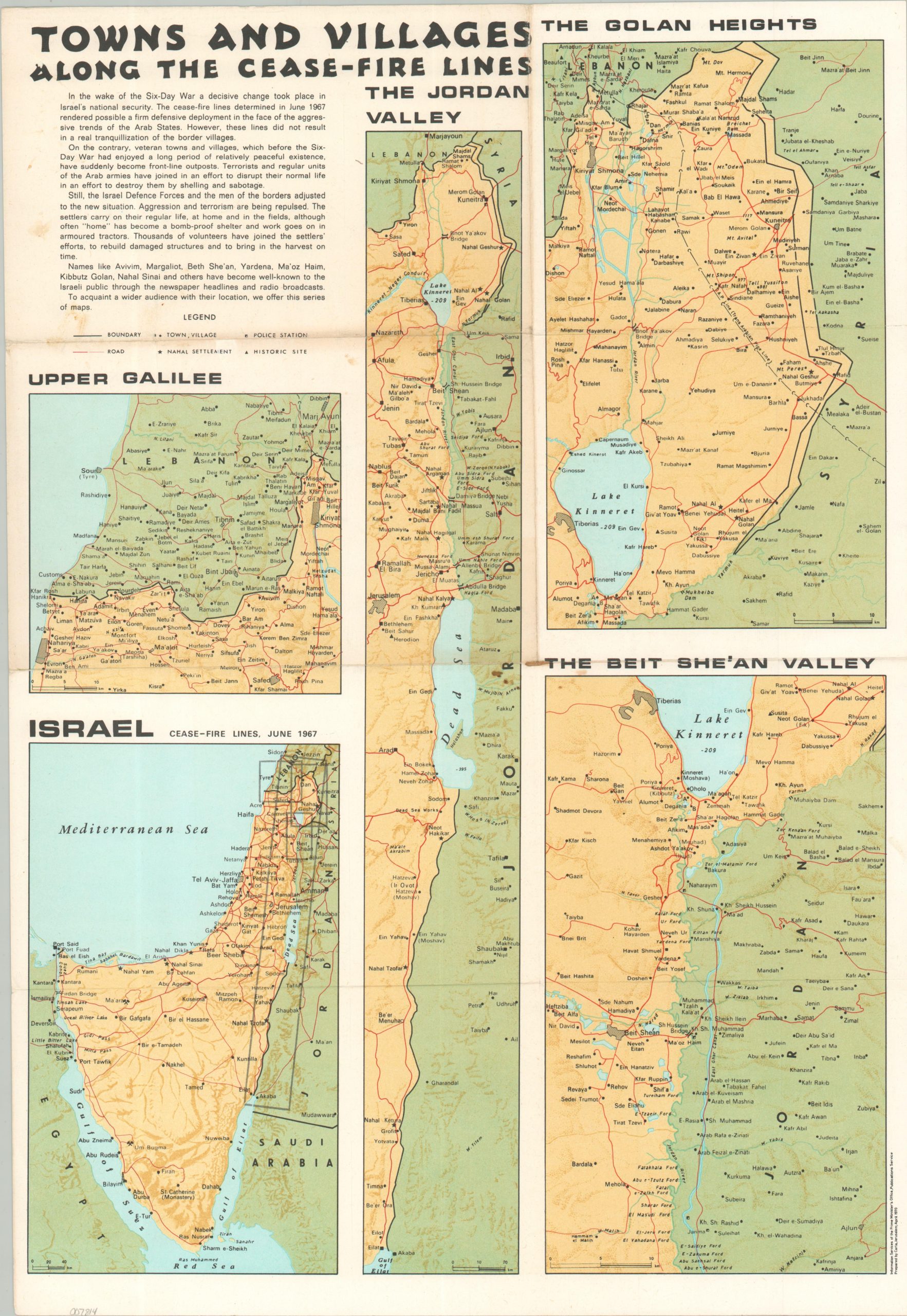
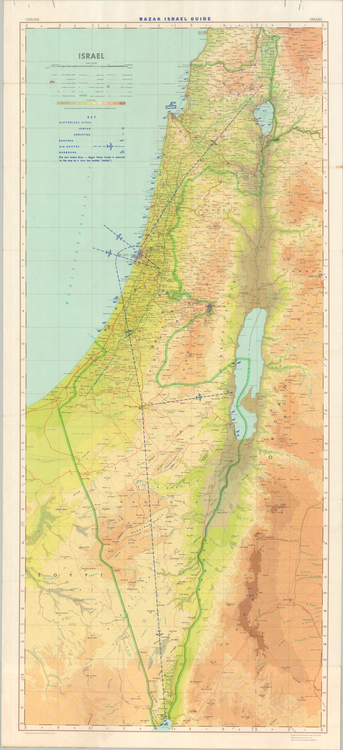
This ephemeral map of Israel was issued by Bazak Israel Guidebook Publishers in 1967 to celebrate and commemorate the recent victory during the Six-Day War. The back cover presents a summation of the nearly weeklong military action, which saw Israel decisively defeat a coalition of Egypt, Syria, and Jordan. The base topographic map, designed by the Survey of Israel in 1965, has been overprinted with blue to identify Jewish and Christian historical sites, beaches, air routes, and harbors. Outdated borders reflect the 1949 Armistice Agreements – the ceasefire from the Six-Day War would effectively triple the size of the territory under Israel’s control.