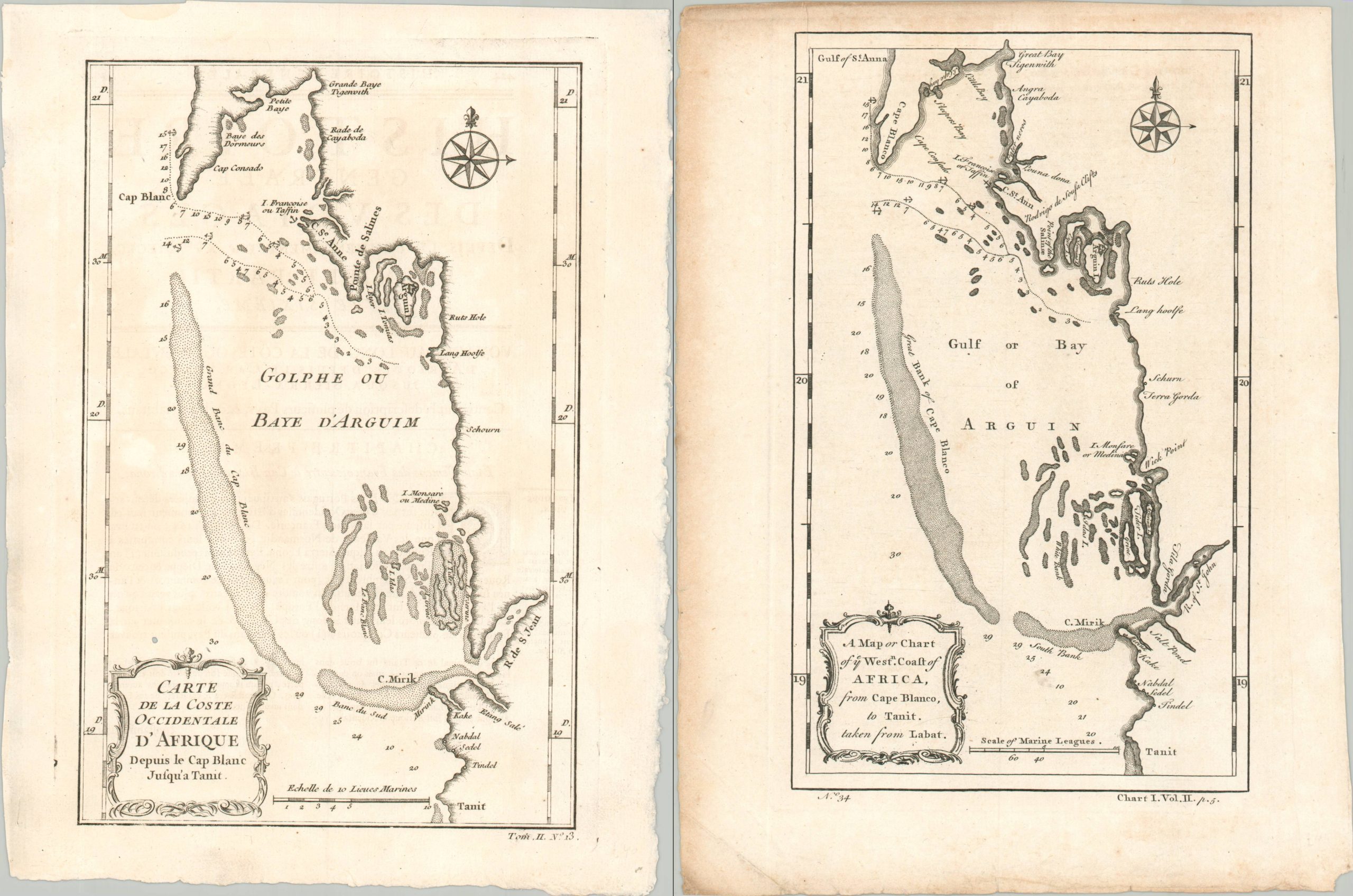
Carte de la Coste Occidentale D’Afrique Depuis le Cap Blanc Jusqu’a Tanit [with] A Map or Chart of the Coast of West Africa from Cape Blanco to Tanit, taken from Labat
$23.51
$31.97
This pair of maps, French and English counterparts, provides an interesting nautical overview of the Bay of Arguin in West Africa. Located in modern-day Mauretania, the area was first settled by Europeans (the Portuguese) in the mid-15th century. The construction of a factory (or fortified trading post) on Arguin Island in 1445 represents a very early example of the slave trade that would come to define the economy of much of Western Africa’s coast. The odious industry was still prominent 300 years later, when these two maps were issued. Interestingly, there are a few discrepancies in the toponyms and title, though otherwise the content is largely the same between images. The fort and its slave pens remain visible on the island, amid depth soundings and a handful of settlements and geographic features. Source.