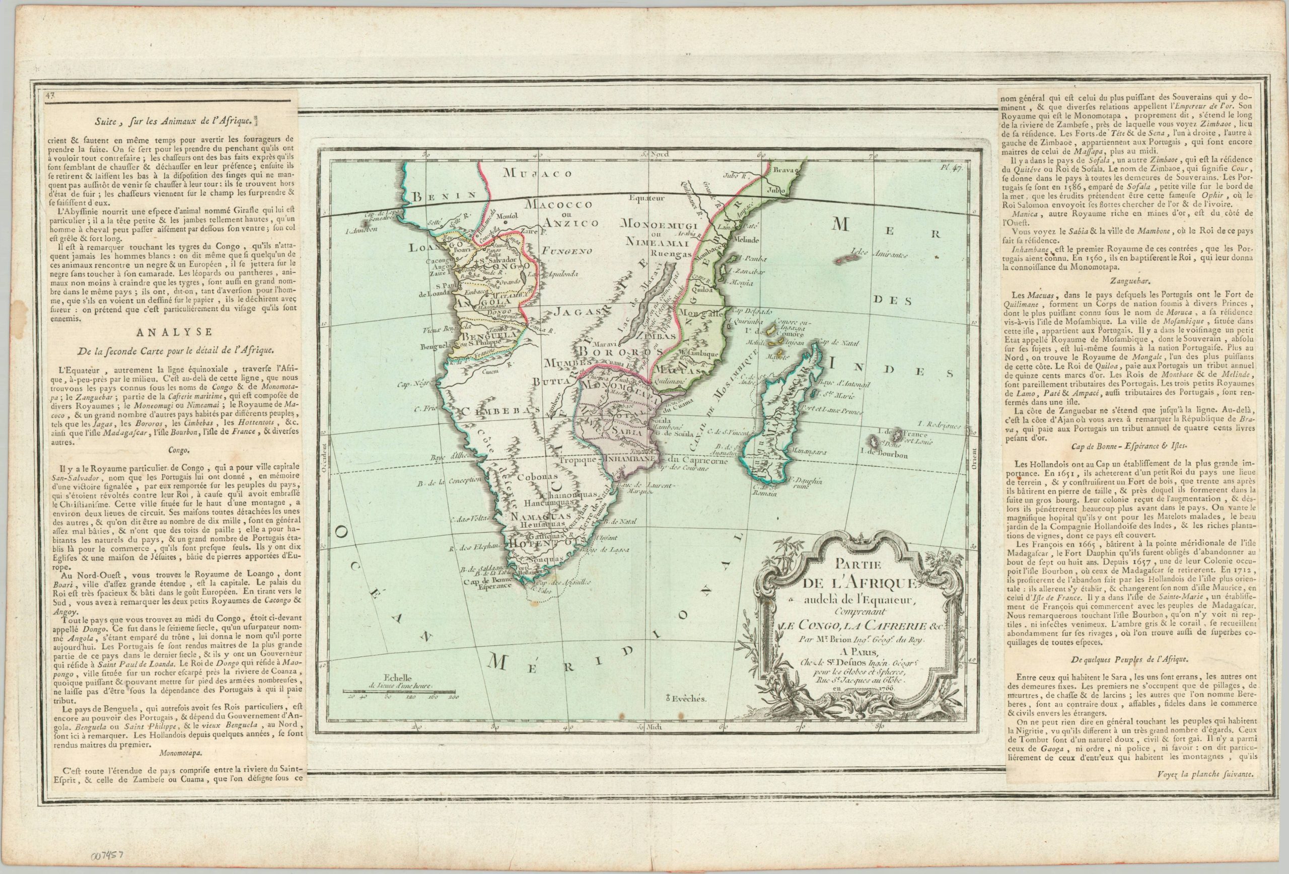
Partie de l’Afrique audela de l’Equateur, Comprenant le Congo, La Cafrerie &c.
$13.26
$24.4
This charming antique map presents the 18th-century European geographic understanding of Sub-Saharan Africa. A handful of political enclaves, outlined and highlighted in hand color, are concentrated along the coastlines, but the interior of the country is quite sparse. Rough topography is depicted pictorially and an interesting variety of settlements, ethnic groups, and geographic features are named. Panels of adjacent text, pasted down atop the base sheet, provide historical details, political information, and various interesting tidbits about the different kingdoms across southern Africa. For example, allegedly, the tigers of the Congo will not attack white men! The map was created by Louis Brion de la Tour and published in Paris in 1766 as part of Louis Charles Desnos’ Atlas Generale…