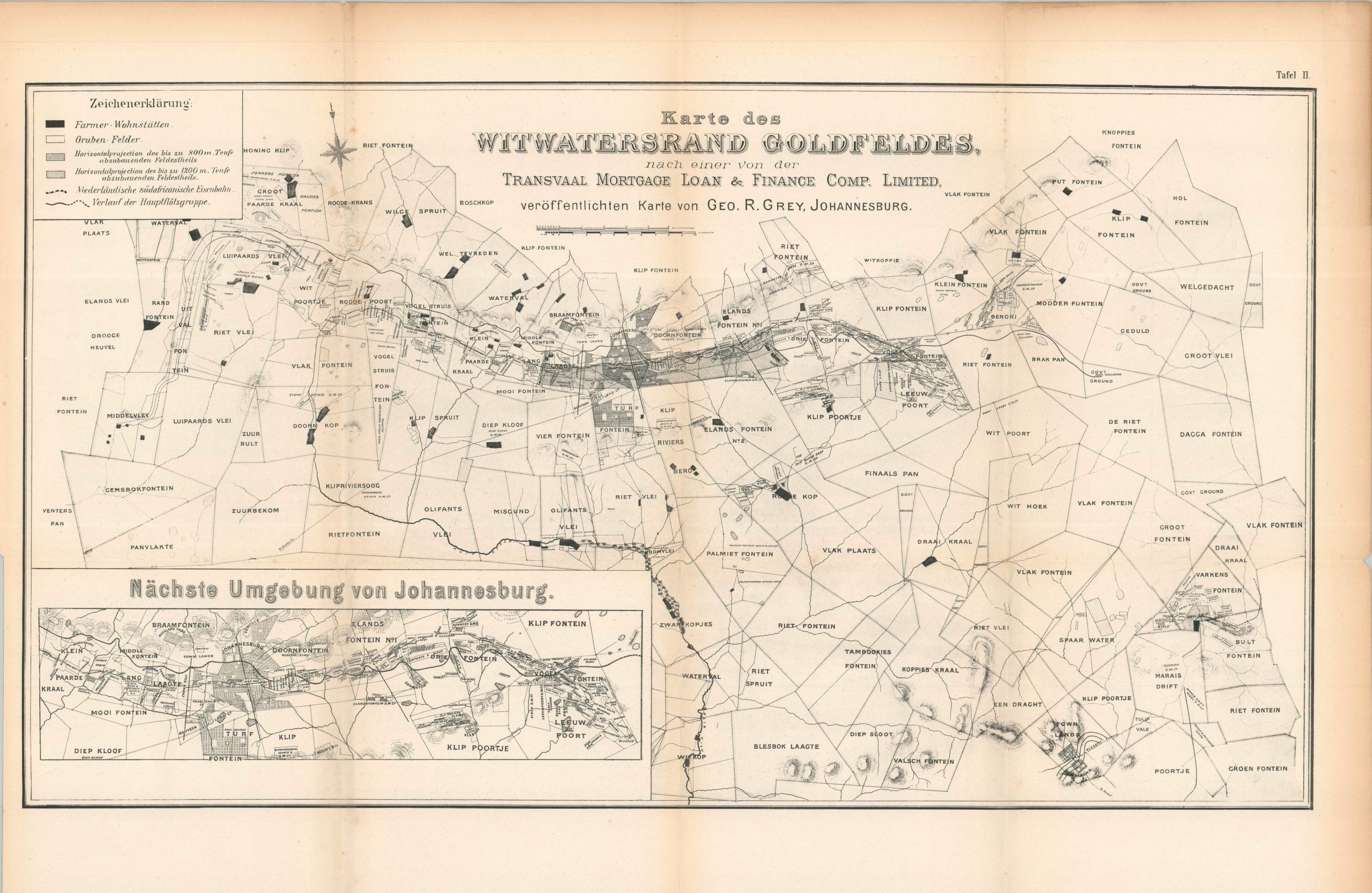
Karte des Witwatersrand Goldfeldes, Nach einer von der Transvaal Mortgage Loan & Finance Comp. Limited
$11.67
$21.94
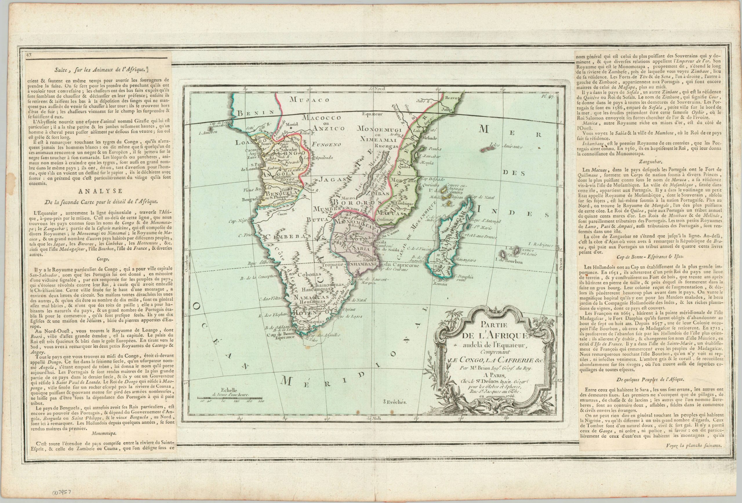
In 1886, gold-producing lands were made available to prospectors in the Witwatersrand Region of the Transvaal Republic, leading to the establishment of Johannesburg and its rapid rise (within ten years) as the largest city in Southern Africa. Unfortunately, the abundance of the precious metal was a poisoned chalice for the Boers, as it dramatically increased tensions with the neighboring British and contributed to the outbreak of the Second Boer War and the ultimate dissolution of their independent republics. This German-language map, published between 1899 and 1906, highlights the explosive growth enjoyed by the region as a result of the Gold Rush. Johannesburg and the adjacent suburbs of Turf Fontein and Yeoville are situated firmly in the center, connected to adjacent areas via railway. Numerous farms are outlined and named, along with mines (with estimated depths of productivity) and the route of the primary gold seam. An inset in the lower left offers further details on the areas immediately around Johannesburg. The map was created by George R. Gray, a suspiciously British-sounding name, which leads me to believe the date of issue was after the end of the Second Boer War in 1902. Published in Johannesburg by the Transvaal Mortgage, Loan, And Finance Company, a financial firm established in 1899 that was renamed to British Empire Land Mortgage and Loan Company in 1906. It was in the founding portfolio of the modern-day AVI Global Trust.